
Baluain map
Information
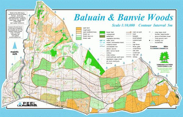
Forestry plantation with some deciduous woodland, open moorland and pastureland.
This area includes plantation coniferous forest and some natural woodland. In the west is the deep gorge of the River Bruar and its spectacular falls, with good paths on either side, and there are forest roads elsewhere. The terrain climbs to the north into moorland and there is some rough open in the SE.
Used for National events (e.g. Scottish Orienteering League).
This area has not been used for some time, due to extensive forestry work.
Location
/-3.92201,56.77467,12/500x400?access_token=pk.eyJ1IjoicGF1bGZyb3N0IiwiYSI6ImNscGg3eGRlMjA0cm8yaW52aGhtY2lxZjQifQ.Lc483ZPI9QPGNrBpcqqywQ)
Near: Blair Atholl Lat,Lng: 56.77467,-3.92201 OS Grid Ref: NN829670 Postcode: PH18 5TN What3Words: ///airliners.download.spots
Open an interactive map in: GoogleMap - OpenStreetMap - AppleMaps - BingMap