
Mountain Bike OrienteeringAn Introduction
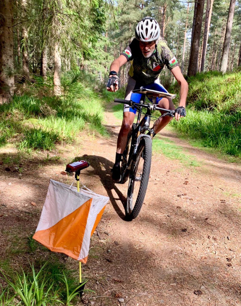
Credit: Walter Clark
MTBO is an Orienteering sport and uses a specially surveyed detailed map (usually 1:10,000) with slightly different symbols to a Foot O map. There is less emphasis on detail in the forest and there is a special grading of path "rideability" or speed of travel (see below). Riding is not very technical and is generally less testing riding skillwise than many people imagine. It is completely OK to jump off the bike and walk or run around any hazard if you prefer to.
First some rules:
- Helmets are mandatory.
- A serviceable bike is required.
- You must stay with your bike at all times.
- You must stay on mapped paths at all times.
- Controls must be visited in numerical order.
- Give way to members of the public on foot or on horseback.
- When overtaking, pass the other cyclist on the right and shout loudly "on the right". In a head on situation, both parties turn to the left.
- Riders travelling uphill must be given priority.
- Take extra when approaching roads with traffic. Obey the Highway Code when on a road.
- At an intersection, the rider on the smaller path must give way to the rider on the larger path.
- Slower riders should give way to faster riders.
- Take extra care when head down reading the map or approaching another rider head down. Shout warnings as appropriate.
- Do not loiter at a control site.
- Move well clear of the track if stopping for any reason (including reading the map).
- MTBO maps are similar to foot orienteering maps but contain less detail. There are no form lines and only 2 grades of forest (white - open forest, green -the rest). Many small contour and rock features are not mapped.
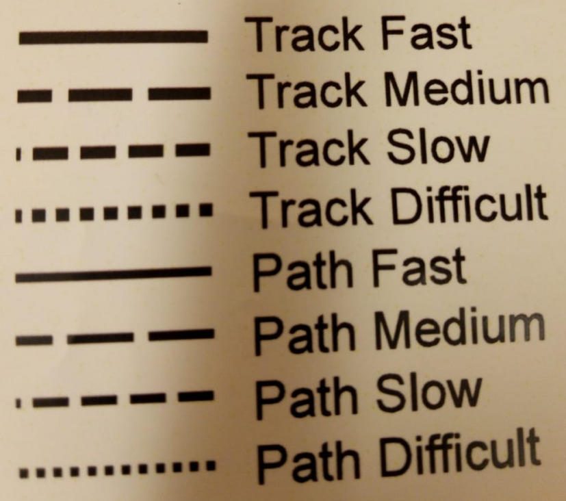
- The main difference from foot orienteering maps is the grading of tracks and paths. Tracks are wide enough for 2 cyclists to pass and paths are narrower and generally difficult for cyclists to pass. Tracks are drawn with thick width black symbol and paths are shown with a narrower width symbol.
- Tracks and paths are classified into 4 speed bands. Fast (75-100% of possible riding speed on a hard smooth surface). Medium (50 - 75%), slow (25 - 50%) and very slow (0 - 25%). Fast is shown with an unbroken line, medium with large dashes, slow with smaller dashes and very slow with tiny dashes that look like dots.
- If an obstacle cannot be crossed or the track/road is out of bounds, a magenta X will be marked on the track/road. This applies to Craigmillar Castle Road, which runs through the centre of the map for courses A and B (north to south) and on the east edge of the map for courses C and D.
- Control descriptions are not used and control codes are not used at this session. The control marker will be in the centre of the circle on the map.
Events will normally use a punching start and either a punching or SI Air finish. Specifics will be given in event details.
MTBO maps are similar to foot orienteering maps but contain less point/contour detail. There are no form lines and only 2 grades of forest (white - open forest, green - the rest). Small contour and rock features are not mapped. Vegetation is much less important.
The main difference from foot orienteering maps is the grading of tracks and paths:
tracks are wide enough for 2 cyclists to pass
paths are narrower and generally difficult for cyclists to pass.
Tracks are drawn with thick width black symbol and paths are shown with a narrower width symbol.
See the key extract.
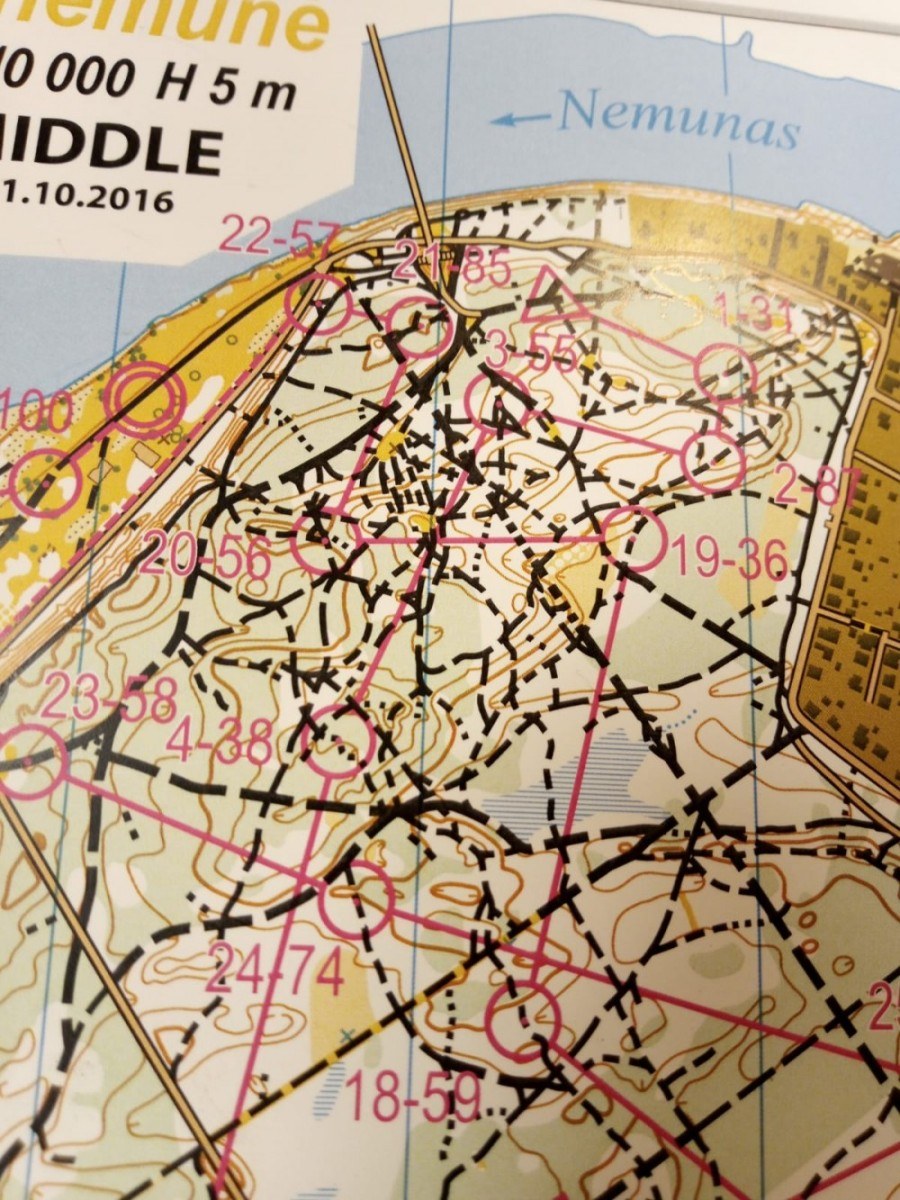
Credit: Lithuanian OF, Kaunas 2016
Tracks and paths are classified into 4 speed bands:
Fast (75-100% of possible riding speed on a hard smooth surface);
Medium (50 - 75%);
Slow (25 - 50%);
Very slow (0 - 25%).
Fast is shown with an unbroken line, Medium with large dashes, Slow with smaller dashes and Very slow with tiny dashes that look like dots.
The map extract on the left is from the World Masters in Lithuania (2016), and shows a complex area with many differing path/track types.
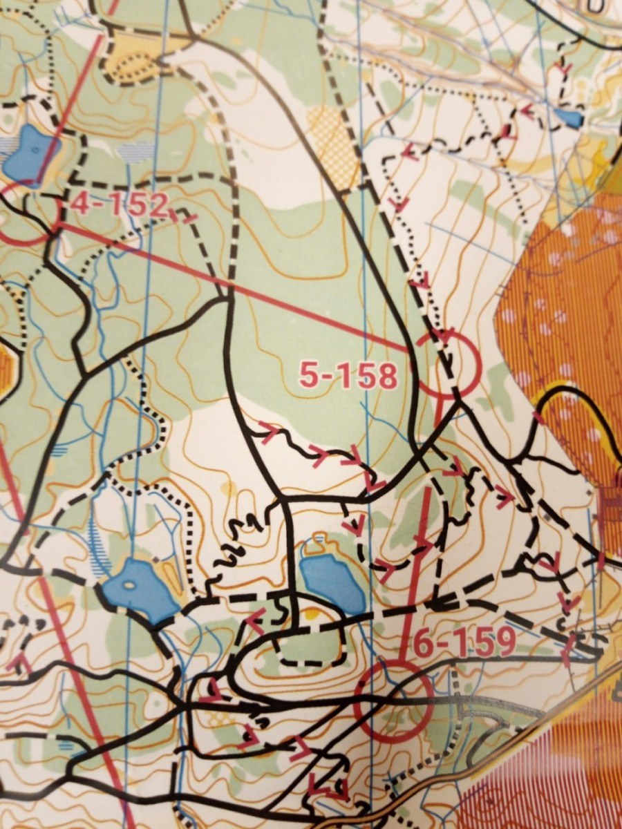
Credit: Drumlanrig GB Champs AYROC 2019
There are 3 important magenta-coloured symbols in use:
- A dash across a track signifies a hazard - usually a fallen tree that can be crossed with care or a passable gate.
- If an obstacle cannot be crossed or the track is out of bounds a magenta X will be marked on the track.
- For one way tracks a magenta V pointing in the allowed direction of travel will be shown, very important at trail centres like Glentress. One way tracks make route choice an interesting challenge. Biking speed and technique makes the navigation on track more difficult than most foot orienteers appreciate.
The map extract on the right is from Drumlanrig, and shows directional arrows on one-way tracks/paths.
Unlike Foot O there are no control descriptions, as almost all controls are sited on paths or tracks. Control codes are printed next to each control on the map next to the numerical order number.
Finally, some technique tips:
- It is best to obtain (or fashion) a mapboard to attach to the handlebars to allow you to read the map easily. The best mapboard allows it to rotate so you can orientate the map on the move. A wrist compass or a small compass attached on the corner of the mapboard allows it to be orientated in the direction of travel. The mapboard does not obscure trail vision as you should always be looking 5m or more ahead in choosing your line to ride.
- In terms of technique, MTBO requires an adjustment of technique compared to Foot O. There is obviously no "thumbing the map" for example. Some experienced riders use small sticky arrows or small coloured magnets on the map to quickly show roughly where they are, but these are not necessary, particularly when starting.
- It is important to glance quickly at the map and extract the maximum information from the map. Map memory and visualisation is a more important skill in MTBO.
- As you are riding faster than you can run, and there is a wider variety of speed on different types of tracks, then it is important to look wider when selecting route choices. It is surprising how far round you can go on a faster flatter road than a hilly slower singletrack (small path). You certainly go faster on a bike and cover greater distances than on foot.
- Try and avoid unnecessary climbing and be careful on downhill legs to avoid too much speed as overshooting a turning can be costly.
- Be careful to travel in the correct direction on one way tracks such as the ones which are designated by trail centres (denoted by a directional arrow).m
- The most important advice for any beginner or improver is just to have fun and enjoy the challenge of combining two great sports in wonderful terrain. It is an amazingly rewarding sport combining physical, bike handling and mental challenge in equal measure.
Keith Dawson
Other entries categorised under: MTBO