
Cramond Foreshore map
Information
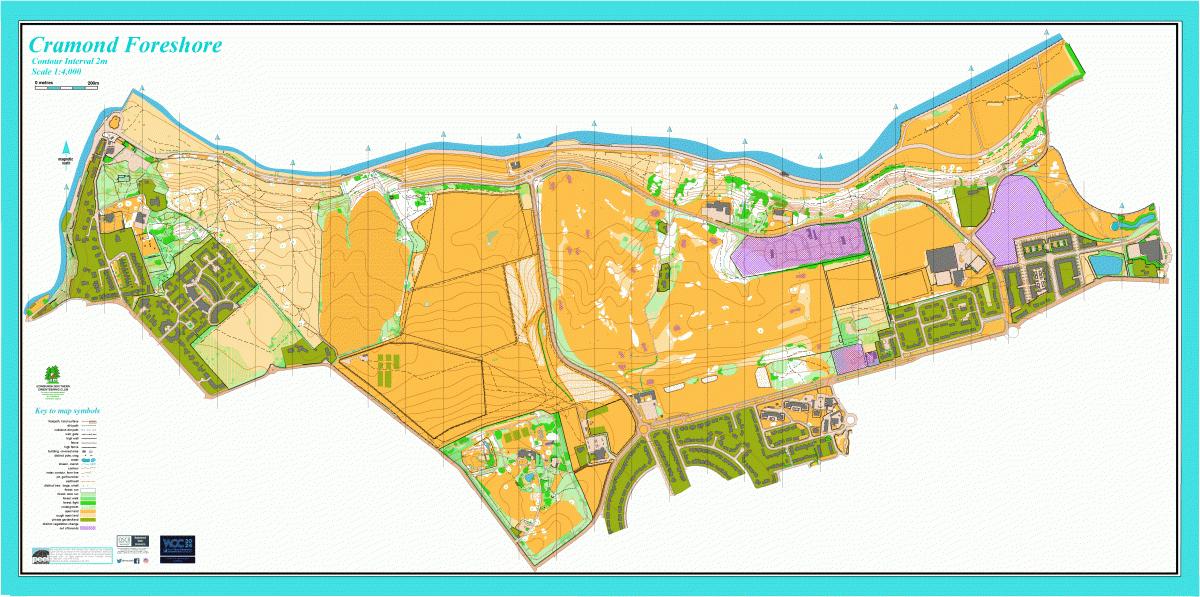
Open land along the south shore of the Forth estuary.
This map covers a large area, stretching from the River Almond in Cramond eastwards to Forthquarter Park in Granton. It includes Lauriston Castle and Silverknowes Golf Course. Lauriston Castle dates from the 16th Century and has formal gardens, open parkland, woods, many paths and ornamental features. Elsewhere, the terrain is mostly open with some woodland, and it slopes towards the north with a steep section near the shore. The map includes some urban terrain.
Used for Local events.
Location
/-3.2724,55.9793,12/500x400?access_token=pk.eyJ1IjoicGF1bGZyb3N0IiwiYSI6ImNscGg3eGRlMjA0cm8yaW52aGhtY2lxZjQifQ.Lc483ZPI9QPGNrBpcqqywQ)
Near: Edinburgh Lat,Lng: 55.9793,-3.2724 OS Grid Ref: NT207770 Postcode: EH4 5EP
Open an interactive map in: GoogleMap - OpenStreetMap - AppleMaps - BingMap