
Penicuik Ladywood map
Information
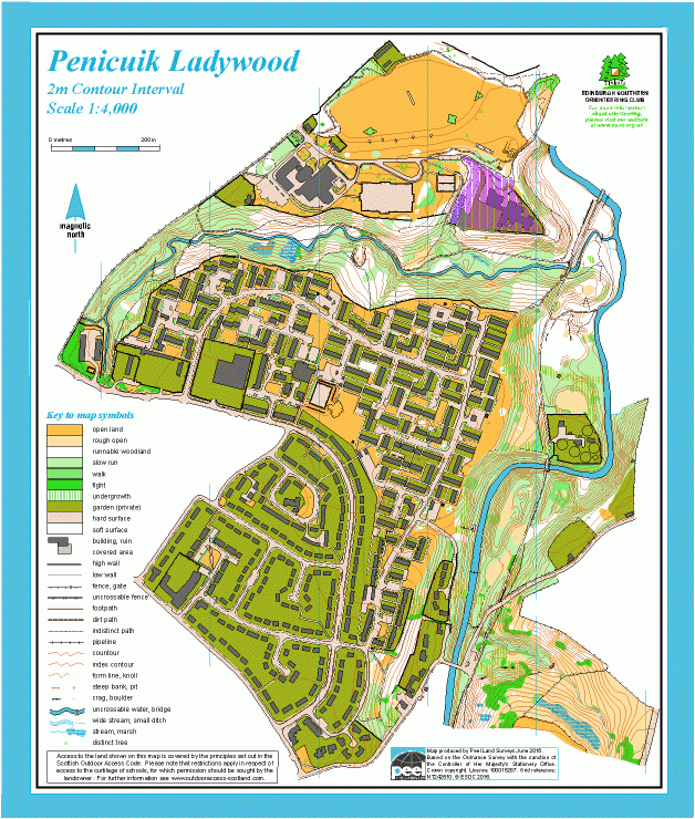
Contrasting terrain featuring complex modern housing and steep woodland.
This map covers the Ladywood housing estate and Beeslack School and Woods. The terrain is a mixture: steep wooded valleys of the Loon Burn and North Esk River, a modern housing estate, a few rough open areas, school grounds and playing fields. The housing estate has many narrow alleyways, courtyards and grassed areas amongst similar-looking buildings, and is excellent sprint terrain.
This map was produced by Dave Peel (Peel Land Surveys), and won 2 awards for 2016, which were presented at the 2017 British Orienteering AGM:
- The Silva Trophy, presented for best map produced by professional mappers
- The Walsh Trophy, sponsored by Walsh Shoes, for the best urban or sprint map to ISSOM standards
Location
/-3.2096,55.836,12/500x400?access_token=pk.eyJ1IjoicGF1bGZyb3N0IiwiYSI6ImNscGg3eGRlMjA0cm8yaW52aGhtY2lxZjQifQ.Lc483ZPI9QPGNrBpcqqywQ)
Near: Penicuik Lat,Lng: 55.836,-3.2096 OS Grid Ref: NT244610 Postcode: EH26 8JL
Open an interactive map in: GoogleMap - OpenStreetMap - AppleMaps - BingMap