
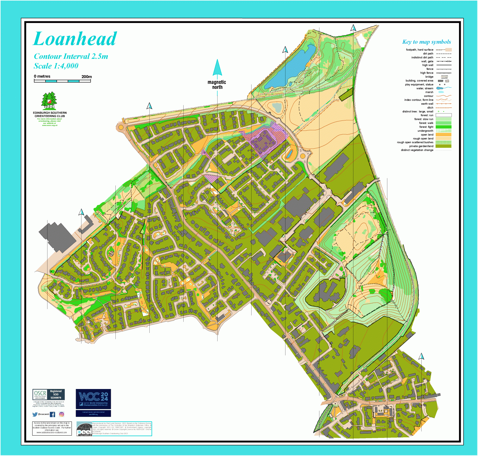
Loanhead map
Information
Urban area to the south of the city.
Loanhead is just beyond the Edinburgh City Bypass. This map covers modern housing estates with narrow pathways through grassy areas, as well as older buildings in the town centre. It also includes wilder terrain around Straiton Pond and Ramsay Colliery Bing, and along the cycle route between them. Straiton Pond was once a clay pit for the local brickworks, and is now a local nature reserve, managed by Midlothian Council. Ramsay Colliery closed in 1965 and the bing has been landscaped.
Used for Local events, e.g. informal summer evening events
Location
/-3.1541,55.8837,12/500x400?access_token=pk.eyJ1IjoicGF1bGZyb3N0IiwiYSI6ImNscGg3eGRlMjA0cm8yaW52aGhtY2lxZjQifQ.Lc483ZPI9QPGNrBpcqqywQ)
Near: Loanhead Lat,Lng: 55.8837,-3.1541 Postcode: EH20 9BF
Open an interactive map in: GoogleMap - OpenStreetMap - AppleMaps - BingMap