
Mavisbank map
Information
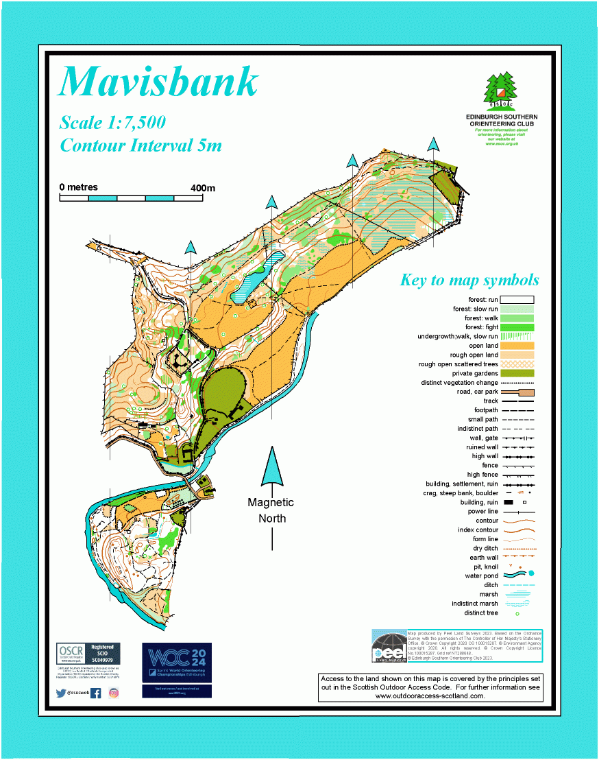
Fields and woods along the valley of the North Esk River.
This map covers land along the North Esk river, between Loanhead and Bonnyrigg, around the ruined 18th century Mavisbank House. There’s a variety of terrain - open fields, marshy areas, and woods, generally sloping down to the SE. There are paths throughout, and a road bridge over the river links to the area covered by the Springfield Mill map, which is also included on this map.
Location
/-3.1392,55.8742,12/500x400?access_token=pk.eyJ1IjoicGF1bGZyb3N0IiwiYSI6ImNscGg3eGRlMjA0cm8yaW52aGhtY2lxZjQifQ.Lc483ZPI9QPGNrBpcqqywQ)
Near: Loanhead Lat,Lng: 55.8742,-3.1392 OS Grid Ref: NT288652 Postcode: EH20 9DB
Open an interactive map in: GoogleMap - OpenStreetMap - AppleMaps - BingMap